 Nederlands
 Dansk
Dansk Österreichisch
 Po Polsku

Printed by https://pinneberg.city-map.de/city/db/020902010101/high-and-low-tide-


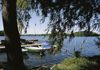
High and Low Tide

Image Copyright: Verlag Temmen
It's roughly 75 kilometres to the North Sea, coming from Wedel Elbe downstream. A distance that speaks tides: low and high tide 'easily' overcome. The high tide runs against the stream of the Elbe, which is the reason for the marking in maps and sea maps flow direction in both directions.
More infos...
source reference:
Verlag Edition Temmen, Autor Werner Scharnweber


")


 - Helgoland's landmark")


